
Ceglak Rally 2024 – searching for a student
WRSS WILiGZ is back! And with them the next edition of the Ceglak Rally 2024!


In the month of June we have some books for our readers in PDF format on CD, we got them from our friendly Faculty Libraries. These are monographs published by the AGH Publishing House. They concern deformations, surface changes, deformations of the mining area, small water reservoirs in Kraków, the Dobczyce Reservoir, as well as soil pollution and the reclamation process. Details can be found below.
Detailed information about our news can be found below this post.
We will provide you with information about our next novelties on a regular basis via the department’s website and on the posted ‘boards’ in the A1 and A4 buildings. At the same time, we want to ask you for help! Improve us by sending suggestions for new book and magazine titles that you would like to see in our offer
We also invite you to have a look at our bookcrossing shelves.
| Author, title, year of the publication | A short description of topic | Book cover |
| Szafarczyk A.: Wyznaczanie odkształceń poziomych terenu górniczego przy zastosowaniu rozet geodezyjnych, wyd. 2013 | The aim of research was to identify the technology of lines of extreme deformation values, measuring geometric constructions – rosettes. This required field research involving multiple measurements placed in 4 effective test fields over mining operations in the area of Upper Silesia. The origin of the research to justify the thesis that the use of geodetic rosettes to measure the main deformation to extend the assessment of the deformation of the mining area and to confirm the verification of theoretical properties that affect the mining operation for forecasting the impact. |  |
| Sopata P.: Wykorzystanie satelitarnej interferometrii radarowej InSAR w badaniach i prognozowaniu pogórniczych zmian powierzchni terenu, wyd. 2013 | The work presents the results of multidirectional research on the use of satellite radar interferometry (InSAR) to monitor the surface of mining areas and to forecast the impact of mining activities on the environment. The research work contains the theoretical foundations of InSAR and extensive information on the method of obtaining radar data and generating interferograms, as well as their interpretation. The author presents specific applications of the method both in terms of monitoring vertical changes in the mining area and forecasting these changes. |  |
| Gruszczyński W.: Zastosowanie sieci neuronowych do prognozowania deformacji górniczych, wyd. 2012 | A method using artificial neural networks to model the values of the asymptotic state of depressions caused by underground mining is described. It allows for indirect modeling of slope and curvature values. The problem of modeling accuracy of deformation indices and estimating this accuracy by appropriate models was discussed. The developed method allows for automation and, unlike the existing solutions using artificial neural networks, it is not related to a specific object, which allows the use of a once-built model on many similar objects and the creation of utility programs that would require little user intervention to build deformation models. |  |
| Gruszczyński S., Eckes T., Gołda T., Sroka K., Trafas M., Wojtanowicz P.: Akumulacja węgla organicznego w utworach bezglebowych, zrekultowanych dla leśnego kierunku zagospodarowania, wyd. 2014 | The book presents results of research aimed at estimating the rate of organic carbon accumulation in post-mining land recultivated in the direction of forestry and analyzing the factors that have a decisive impact on this process. |  |
| Rajpolt B.: Ocena możliwości ograniczenia rozprzestrzeniania się związków fluoru w warstwie wodonośnej, wyd. 2013 | The main objective of work was to search for possibilities to reduce the spread of fluorine compounds in the aquifer contaminated with leachate from the aluminum smelter landfill in Skawina. The results obtained in the course of the work and the proposed solutions can be used not only in the case of the aluminum smelter waste landfill in Skawina, but also in other areas where there is a similar threat. |  |
| Drzewiecki W., Kopacz M., Mularz S., Pirowski T., Tokarczyk P., Twardy S.: Modelowanie ładunków zawiesiny ogólnej w zlewni Zbiornika Dobczyckiego, wyd. 2014 | This is a summary of research conducted as part of research project financed by Ministry of Science and Higher Education entitled: Modeling the impact of changes in land use on the size of the load of sediments potentially accumulated in retention reservoirs using multi-time multi-spectral remote sensing images and geographic information systems on the example of the Dobczyce Reservoir. The aim is to determine the possibility of using spatial erosion models implemented in the Geographic Information Systems (GIS) environment to estimate the impact of land use in the Carpathian catchments on the size of the suspended solids load in surface waters supplying the retention reservoir. |  |
| Jakubiak M., Panek E.: Małe zbiorniki wodne w zachodniej części Krakowa, wyd. 2017 | The work is addressed to people dealing with environmental protection issues. The aim of the monograph was to make an inventory and natural characteristics of small water reservoirs in the western part of the Kraków agglomeration and to propose the protection of selected reservoirs, including artificial reservoirs, which differ from natural reservoirs but fulfill similar ecological functions. The descriptions also apply to the surroundings and the catchment area in the vicinity of the reservoir. The tanks were inventoried in the field according to the criteria. A uniform documentation scheme has been adopted. Some of the existing facilities are located on private land and access to them is difficult – a short diagram was used to describe them. |  |
| Cisło-Lesicka U.:Konwersja bazy danych topograficznych do postaci 3D, wyd. 2013 | The rules for converting 2D TBD objects to 3D and ways of graphical presentation on the Internet have been developed. For this purpose, a conceptual model of three-dimensional multi-resolution topographic databases (TBD3D) was created, which assumes that TBD3D will be an additional module of TBD 2D, enabling 3D visualization and spatial analysis. Thus, a new taxonomy of TBD3D objects was created at 3 different levels of detail and a catalog of 3D symbols. Good data sources (stereodigitization, LIDAR) and algorithms for photogrammetric and CAD programs were indicated. Then, taking into account the principles of 3D data acquisition, sample TBD3D databases were created for a selected part of the city. |  |
| Krzyżek R.: Zastosowanie RTK/RTN GNSS do pomiarów wykonywanych w celu opracowania map wieloskalowych, wyd. 2014 | The work attempts to verify the accuracy of determining terrain details that are difficult to access with the RTK/RTN GNSS technology using indirect measurement methods. The individual measurement methods were ordered according to the accuracy of the results obtained. | 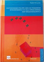 |
WRSS WILiGZ is back! And with them the next edition of the Ceglak Rally 2024!

We invite everyone to participate in the oLEANpiada which oLEANpiada will be held on April 22, 2024 at the AGH University of Science and Technology in Krakow.